Sunbury Rings Cultural Landscape
Sunbury Rings (Jacksons Creek) Cultural Landscape [SRCL] workshop, March 2015
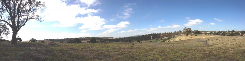
On 13 March 2015 the Trust’s Advocacy & Conservation team and our facilitator Rueben Berg headed up to Sunbury for a day of workshops and discussions with key stakeholders about the Sunbury Rings Cultural Landscape (SRCL). The SRCL is a dramatic and significant landscape in Sunbury that covers Jacksons Creek and its valley from Emu Bottom in the north to the Holden Flora and Fauna Reserve in South Sunbury. The landscape north of Sunbury was our focus, and includes several key owners and stakeholders notably Registerd Aboriginal Party the Wurundjeri Tribe Land Cultural Heritage Council Inc., Hume City Council, and Salesian College.
We were delighted to be joined by representatives from each of these organisations as well as the owners of Emu Bottom, planners from the Metropolitan Planning Authority (MPA), Aboriginal Affairs Victoria, Melbourne Water and local community group Friends of Emu Bottom Wetlands.
We started the day at the Rupertswood Gatehouse and a quick overview of the history of Rupertswood and the Clarke family and their role in the history of Sunbury and the SRCL. The Clarke Estate was one of the biggest landholdings in Victoria in the latter 19th century and the pastoral use of Jackson’s Creek under Clarke is continued today by Salesian College and their agricultural training programs.
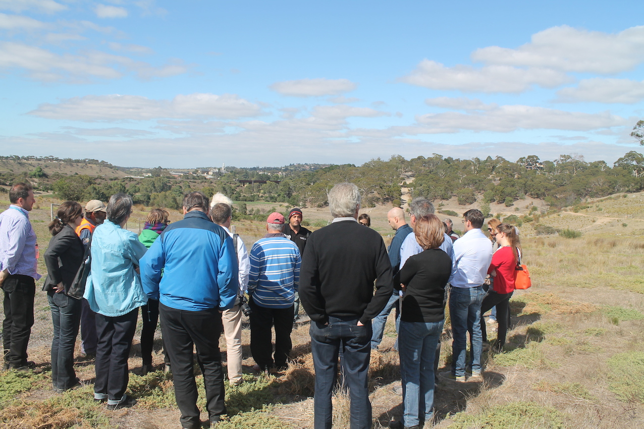
Our next stop was the three Aboriginal earth rings that give the landscape its name. We were honoured to be welcomed onto country by Wurundjeri elders and told about their connection to country and the importance of the Sunbury Rings to the ongoing cultural practices and living cultural heritage of the Wurundjeri. Archaeologist David Frankel undertook investigations into the Sunbury Rings in the 1970s and was able to explain the results of his investigations. Dr Frankel agreed with the traditional owners that the significance of the three Sunbury Rings at this location resides not merely in their physical manifestation (shallow but originally much more pronounced depressions) but in their relationship to each other, their immediate surroundings and their relationship to the broader landscape, including important view lines.
After a visit to the Emu Bottom Wetlands and a look at the regeneration work the community has achieved there over the last decade we convened at Emu Bottom Homestead for our discussion of the future of the Sunbury Rings landscape. Sunbury is identified as a key urban growth areas for the next thirty years and the MPA is leading the planning, including the creation of Precinct Structure Plans to guide development. Several key strategic and technical documents have just been published by MPA that will be included in the forthcoming planning scheme amendment, and these will be closely scrutinised.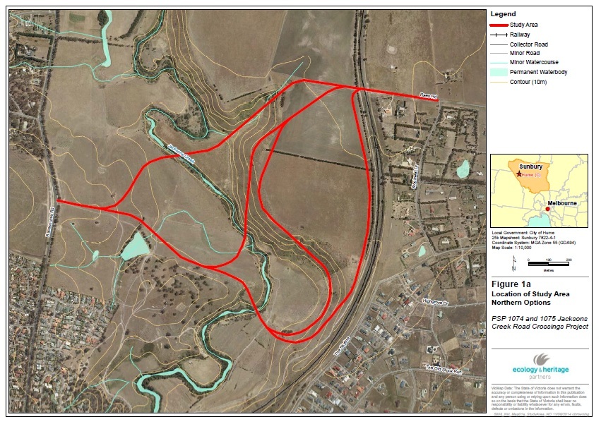
Road bridge and crossing alignment options
Jackson’s Creek is a key geological feature in the Sunbury region and acts as a natural barrier to road linkages. Sunbury itself is built on the site of an early European ford crossing but there are no other crossings north of Sunbury across Jacksons Creek. The MPA flag in the draft PSP documentation to build a crossing – road bridge – across the valley to link existing development on the west side to future development on the east. This has the potential to significantly impact on the cultural landscape values of the site. What emerged from the discussion was a clear tension between planning for future growth and maintaining and conserving the significant cultural and natural values of the Sunbury Rings landscape.
The National Trust, working with Wurundjeri and other stakeholders is committed to protecting this rare and significant landscape and a working relationship with all the stakeholders is important in the ongoing efforts for protection, recognition and interpretation.
Michelle Bashta, Paul Roser and Anna Foley.
+ There are no comments
Add yours