You Yangs sand mine
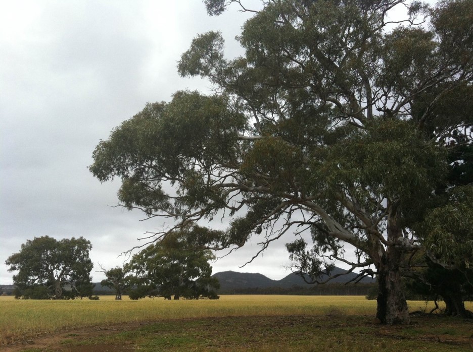
On the western slopes of the You Yangs, a new sand mine is proposed, threatening the rural idyll of Wooloomanata station on Hovells Creek and the scenic views from Flinders Peak.
Located at 405-455 Sandy Creek Road in Lara on the ourskirts of Geelong, the proposed sand mine falls within Significant Landscape Overlay Schedule 1 (SLO1) – Foothills of the You Yangs. This is the first time an application for a sand mine has tested the SLO1 since it was applied in 2006. The SLO1 maps show that the extent of the overlay covers close- and middle-distance views of the You Yangs, by protecting the landscape character of properties adjacent to the You Yangs Regional Park. The SLO1 givens an extensive account of the key elements of the significant landscape, in particular noting that ‘… the open landscape character of the area makes it susceptible to visual intrusion from inappropriate development.’
The most recent assessment of the landscape values of the You Yangs is the 2013 DPCD South West Victoria Landscape Assessment Study which identifies the site as a landscape of state significance and identifies Sandy Creek Road as a major viewing corridor for this landscape. Click here to view the relevant pages of the 2013 DPCD report.
The National Trust has three main concerns with the proposal:
1) The proposed sand mine does not protect landscape areas and vantage points of high quality.
No landscape assessment has been prepared to assess the visual impact of the site in the locality’s key vistas. The DPCD South West Victoria Landscape Assessment Study (2013) identifies that notable viewing locations within this landscape include Flinders Peak Lookout and Big Rock Lookout. The same report identifies Sandy Creek Road as a major viewing corridor to the You Yangs. Photos of the site from key viewing points show that it will be prominently visible from these locations, creating a significant visual impact on the landscape. Due to the topography of the western slopes, and the location of this sand mine on the plains below the break-of-slope, it is possible that this mine will be more visible from the notable viewpoints in the You Yangs than other existing mines, which were approved prior to the gazettal of the SLO. This level of impact is unacceptable within an area identified within SLO1.
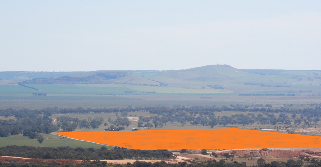
Approximate location of proposed sand mine (marked in orange), viewed from You Yangs Regional Park. The Red Gums lining Hovells Creek are clearly visible immediately behind the site.
2) The conservation of significant areas of natural vegetation and significant stands of trees immediately downstream of the mine
The destruction of the hydrology of the Hovells Creek catchment flowing from the western You Yangs by the construction of another sand mine has potential to cause severe damage to the River Red Gum (Eucalytpus camaldulensis) woodland along the Hovells Creek as it passes through private land, both on the subject property and on neighbouring properties downstream such as Wooloomanata. This upper section of Hovells Creek has been previously identified by the Department of Conservation and Environment as a site of national faunal significance. It has exceptionally high species diversity with over 142 species being recorded on the Atlas of Living Australia within 1 km of Hovells Creek at Lascelles Dam, including 12 mammals (six of which are species of bats), 119 birds, 7 reptiles, and 4 frogs. Anecdotal evidence suggests these figures could be higher, but have not yet been recorded by local field naturalists on the Atlas database. The riparian area provides breeding habitat for locally rare species including Rainbow Bee-eater.
The National Trust, having recently visited Wooloomanata, has begun the process of nominating significant trees adjacent to the Hovells Creek to the National Trusts of Australia Register of Significant Trees.
3) An absence of screening vegetation, and limited potential for any future revegetation
The subject site is adjacent to a grassy road reserve for the majority of its frontage to Sandy Creek Road. Where native vegetation patches occur within the road reserve, plants grow to a maximum of 4 metres. Ask any of the local farmers about the geology and microclimate of this area, in a rainshadow and with poor soils, and they’ll tell you that conditions are not conducive to fast revegetation. Previous examples of revegetation along Sandy Creek Road demonstrate extremely slow growth, or have failed to establish at all. Retention or planting of buffer vegetation is not expected to ever be adequate to mask the development from detrimentally impacting the landscape. For the same reasons, there are doubts over the capacity for the site to ever be adequately remediated in future. Other decommissioned sand mines along Sandy Creek Road have been abandoned by past owners, and there does not appear to be any evidence of rehabilitation – any attempts at revegetation appear grossly unsuccessful. The proposed works have the potential to create additional visual scars on the landscape, indefinitely.
In conclusion, the National Trust is concerned that the proposal does not comply with the following landscape character objectives of the SLO1:
- To protect and enhance the … scenic quality of the landscape.
- To protect the landscape from visual intrusion by inappropriate… works and their siting, design or materials
- To encourage the siting, design and landscaping of buildings and works to responsive to the landscape values of the area
We understand that this is the first application for a sand mine under this SLO1 since it was gazetted, and this case will really test the resolve of decision-makers in protecting an area that is so clearly important to Victoria.
Given the landscape has been identified as being of state significance, and the aforementioned impacts on downstream areas of natural significance within the landscape, visual intrusion from key viewpoints, and the severe constraints on revegetation or remediation within the site, this proposal is not compatible with maintaining the visual and natural significance of the landscape.
The local community held a town hall meeting on 22 October which was attended by over 130 people, including the National Trust Geelong and Region branch volunteers and the National Trust advocacy team. In addition to the formal objection by the National Trust, over 200 objections have been received by the City of Greater Geelong so far. Should you have any concerns regarding this proposal, you can still e-mail [email protected] – quote Permit Application Number 692/2015.
It is expected that the Council’s officer’s report will be completed in November, with the Councillors making the final decision at a Council meeting in late November or December.
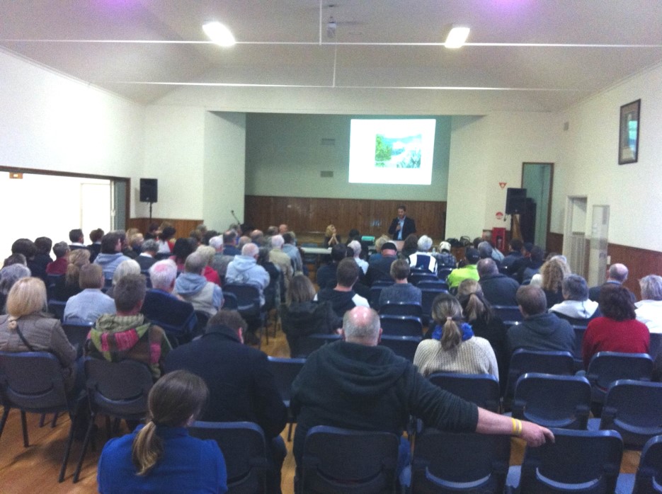
Town Hall meeting at Lara, 22 October 2015
+ There are no comments
Add yours